Angela Gray remembers colder, more predictable winters when she was a child.
The 42-year-old Maplewood resident found herself discussing that topic with friends last week after a late winter blizzard dumped upward of 10 inches of snow on the Twin Cities metro, with parts of southern Minnesota seeing as much as 13 inches.
By Sunday, which reached a high of 60 degrees in the Twin Cities, that biggest snowfall of the season was all but gone. Extreme swings in snow cover and temperatures — shooting from frostbite warnings to shorts weather — can feel like whiplash, Gray said. Like in mid-February, when Twin Cities-area temperatures dipped to minus 15 degrees, prompting her son's high school to cancel classes, only to hit 52 degrees less than a week later.
"They're canceling schools. And then a few days later, I wore a sweatshirt to work," she said. "It doesn't make sense."
Minnesota winters have always been relatively volatile, climatologists point out, largely due to the state's location in the middle of the country, far from the oceans that help temper dramatic shifts in weather. Spring and fall can be especially unpredictable.
But as the planet's average temperature continues to rise, some scientists believe that change could be making wild swings in weather more common — a phenomenon often referred to as "weather whiplash." Some recent studies suggest that global warming could be destabilizing historic weather patterns near the Arctic, which can fuel dramatic shifts in temperatures or precipitation in other parts of the world.
Could that explain some of the bizarre winter weather Minnesota has seen in recent years?
"It's definitely a good question," said Stefan Liess, a researcher in the University of Minnesota's Department of Soil, Water and Climate. "Although some theories exist that link weather whiplash to climate change, it is still contested science."
Liess and some of his colleagues hope to find some of the answers. Soon, he said, they plan to publish new research that looks at how warming temperatures could be increasing the frequency of heavy snow and rain in the state, including during the winter.
Minnesota has generally become wetter in recent decades, with much of the Midwest now experiencing 5% to 15% more precipitation compared with the average between 1901 and 1960, according to the most recent National Climate Assessment. The state climatology office, part of the Minnesota Department of Natural Resources, has updated its latest 30-year average to show that annual precipitation in the Twin Cities area has increased by an inch since the last average, taken between 1981 and 2010.
That has translated to more snow, said Peter Boulay, a climatologist with the DNR. In that sense, this winter and last winter appear to be outliers, he added. Even after last week's big snowstorm, Boulay said, Minnesota has received just 25.6 inches of snow this winter, nearly 16 inches short of what's considered normal. Last winter — the state's hottest on record — was even drier, he noted, with only 14.3 inches of snow falling by this time of year.
If the overall trend is more precipitation, why do some Minnesotans feel they are seeing far less snow? Climatologists say that's likely because Minnesota winters are getting warmer, bringing more frequent snow melt and even more rain.
"We're having more midwinter melts — days where, in the dead of winter, it gets above freezing — and so we're not retaining the snowpack like we used to," said state climatologist Luigi Romolo. "We are seeing more rain events in the winter, too. And nothing melts snow faster than rain."
The trend has meant less time with snow on the ground and a higher probability of unsafe ice conditions. That has been a major headache for businesses that depend on winter tourism and for outdoor recreationists.
"It's having a huge impact on winter recreation because we can't retain the snow," Romolo said. "There's less days for snowmobiling. It makes ice fishing more dangerous, because whenever you have snow melting on the ice cover, that can compromise the mechanical strength of the ice."
Minnesota has warmed about 3 degrees over the last century, and data shows that most of that is happening between October and April. As a result, Romolo said, Minnesota's winter is shrinking — with the first day to drop below freezing in the fall occurring later and the first day above freezing in the spring occurring earlier.
That could help to explain the growing perception of so-called weather whiplash, Romolo added. Autumn and spring are naturally volatile, he said, so it would make sense to see that volatility creep into months historically considered more stable.
In January, the state's coldest month, temperatures in the Twin Cities fell to minus 19 degrees before rising to 52 degrees nine days later, a 71-degree swing, National Weather Service records show. Still, weather experts caution about drawing too many conclusions from such events, noting that Minnesota has long seen wild changes in temperature.
Boulay pointed to February 1996 as an example, when temperatures in parts of Minnesota dropped to minus 60 degrees before rising to 48 degrees a week later — a staggering 108-degree swing.
"That's probably the most dramatic example of something like that," he said.
Gray, however, still feels like something is off. On one particularly cold day this winter, she remembers her car tires looking as if they had gone flat. Subzero temperatures had reduced their air pressure. A day or two later, she said, the tires went back to normal, like magic.
She's not complaining, though.
"As much as it seems crazy, I love that peek of nice weather," Gray said. "If we're going to have a long winter, I enjoy at least having those moments or days we get to enjoy when the sun is out."

Klobuchar wants to extend tax credit for plant-based jet fuel, but environmentalists say the climate could suffer

Why now might be the best time to make a deal on boats, ATVs and other powersports

Lupine is starting to bloom in Minnesota. Here's where to find it.
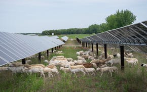
Xcel lets loose a small army of hungry sheep to keep its solar farm in order