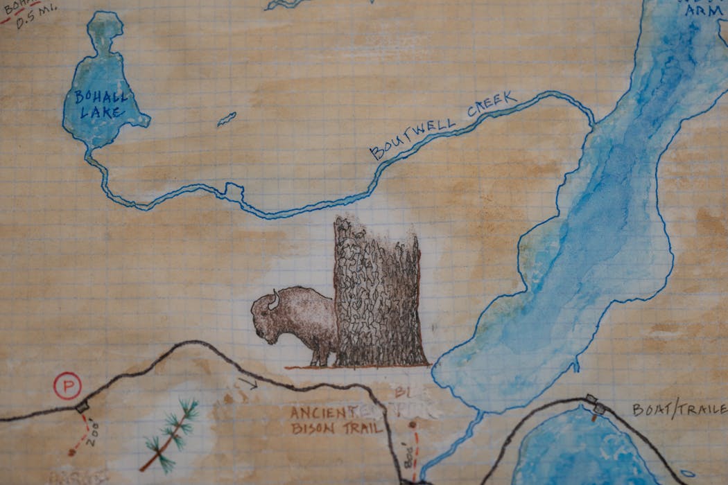
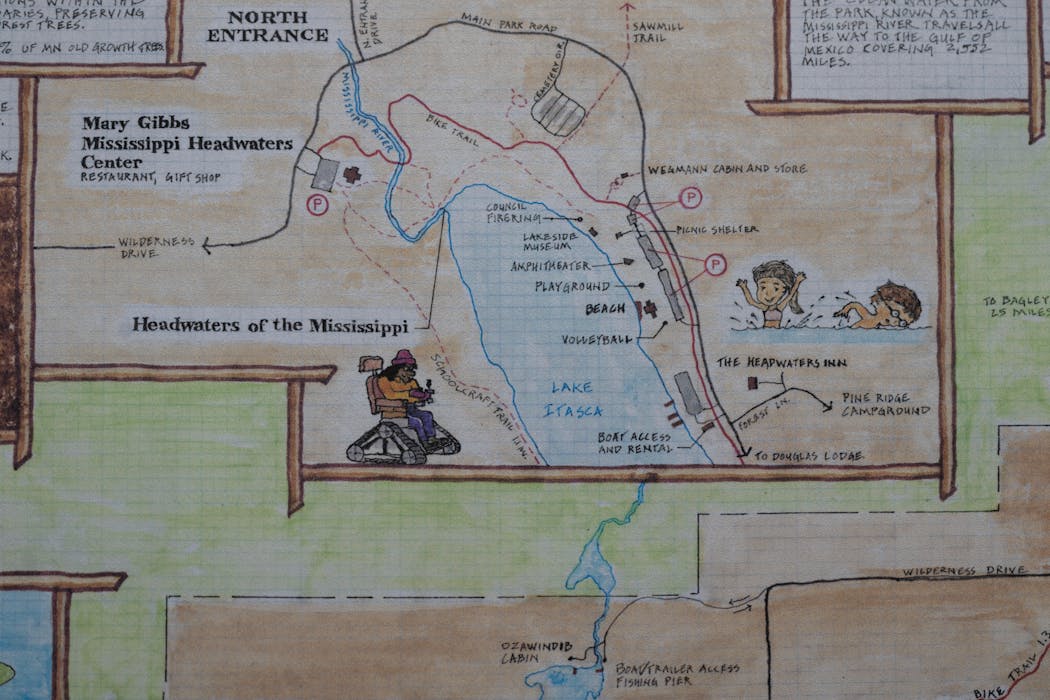
Keith Myrmel's paper maps transport the user to a mental space that is the antithesis of our digital world.
His craftwork is simple — accessible — while precise with its visuals and text. Like that of a plein air artist, whose office is the outdoors, his finished work has an authenticity that suggests he worked the maps in the moment, too — say, while sitting on a rocky outcropping on the North Shore, or embedded deep in the North Woods.
His large-scale projects include the Superior Hiking Trail that runs along Lake Superior; the 4,800-mile North Country National Scenic Trail; and a sweep of Minnesota's Arrowhead region (including all of the Boundary Waters Canoe Area Wilderness and its entry points).
Now, Myrmel, of Arden Hills, is about to print another about a year in the making: Itasca State Park.
"My hobby turned into a little business," said the former landscape architect.
It seems fitting that Myrmel has settled on Itasca given his treatment of other notable Minnesota and Midwest public lands. Itasca is Minnesota's oldest state park and remains one of its most popular of all 75 parks and recreation areas. Home to the Mississippi River's headwaters, Itasca is year to year among the most-visited parks.
The seed of an idea took root when Myrmel was delivering North Country Trail (NCT) maps to Ely, knowing the far-reaching trail ran through Itasca. He was reminded of his young life as an intern from the University of Minnesota for the Chippewa National Forest in north-central Minnesota and even a childhood trip to the park.
Turns out, Itasca park store managers were interested in a new, souvenir map. Myrmel got to work, carrying through an attention to storytelling through mapmaking that has become his signature. His maps (myrmelmaps.com) have ended up behind glass on walls and folded into backpacks. Part infographic, part navigation tool, part work of art.
Myrmel's Itasca map, for example, notes the location of a bison kill site, where the park's Wilderness Drive project decades ago was held up after bones were unearthed. The detail reflects Myrmel's deep interest in the state's Indigenous communities. There are references to the Santee Dakota who were followed by the Ojibwe people on the land long before it was swept up by federal and private ownership before becoming a state park. Ojibwe tribal member Ozaawindib helped explorer Henry Rowe Schoolcraft find the headwaters. Myrmel notes that, too.
Native American history also informed Myrmel for a map he created with the Bois Forte Band of Chippewa and the Ely Folk School. The work, which took two years to finish, features the original Ojibwe names and meanings of more than 100 sites, including rivers, lakes and islands, in the Lake Vermilion area. Myrmel worked with Bois Forte artist Louise Isham.
Myrmel said his architectural background and the inherent question in design — form or function? — are foundational to what he is producing, beginning with his Superior Hiking Trail map in 2017.
"The way this ties in with cartography for me has taken my approach back to the simple beauty of ancient mapmakers. They did the best they could on the functional aspect with limited knowledge, but always used their skills as artists to create a piece of art.
"For today's cartographers, they are making functional maps, highly detailed with enormous amounts of data. As an artist and architect, I've always loved seeing these old maps, globes and artifacts that make the project beautiful. But also, as much as possible, use the current information to make the map useful."
As a maps curator with experience in the wild places of northern Minnesota, Ryan Mattke is familiar with "the fresh take" of Myrmel's work.
Mattke, head of the John R. Borchert Map Library at the University of Minnesota, said Myrmel is blending something unique, echoing the hand-colored qualities of some Old World maps printed from woodcut or copper-plate engravings. There are four Myrmel maps in the library collection.
"They do have lots of information and at the same time are beautiful to look at and have a lot to explore visually," Mattke added.
Myrmel said there is no singular inspiration. In some ways, his maps can reflect several things: his experiences outdoors by foot and paddle, his interest in people's relationship to the natural world and landscapes, and what comes naturally when he puts watercolor, ink pens and even pencils to paper.
"It is an interesting thing … I didn't realize how many people just love maps," Myrmel said.

Frost seek late-season spark as stars return from the IIHF World Championship

Podcast: Wild seize the night; Can the Timberwolves do the same?

Five extra points: Vikings, McCarthy win on Day 1 of draft, but the biggest winner was ...

Kaprizov scores twice, Boldy stays hot as Wild skate past Vegas in Game 3


