The Mississippi River nearly lapped at the edges of the Minnesota Boat Club on Raspberry Island in St. Paul Tuesday afternoon, as waters in the capital city approached major flood stage.
The river, on the rise with recent heavy rains, has also overtaken some bike and pedestrian paths near its banks, and high water has led to the closure of flood-prone park areas and roads, including Shepard Road from Eagle Parkway to Hwy. 61, Childs Road and Water Street.
As of 6 p.m. Tuesday, a National Oceanic and Atmospheric gauge on the Mississippi River at St. Paul put the stage of the flood at 17.02 feet — just over what's considered major flood stage at the site.
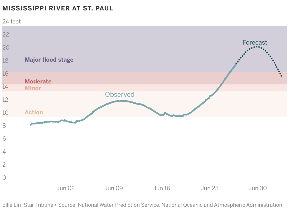
The river is forecast to continue rising through the end of the week, cresting at 20.9 feet in the early hours of Saturday.
In St. Paul, the low-lying areas along the river are largely parkland, so this level of flooding mostly poses problems for public infrastructure, said Public Works Director Sean Kershaw, who had just left the levee on a flooded Harriet Island, where he expects water to flood the playground and reach the performance stage when the river crests. "It's not a situation where homes are at stake," he said.
That's well below the record crest for this site: Waters reached a flood stage of 26.01 feet in 1965. The river last surpassed 20 feet at the St. Paul gauge in 2019.
The St. Paul Parks and Recreation urged St. Paul park users to be cautious around high water, noting that water levels can change quickly and without warning. Information on St. Paul park closures can be found at stpaul.gov/departments/parks-and-recreation/special-notices-closures.

Want to share info with the Star Tribune? How to do it securely

'Safe recovery sites' would offer syringes, naloxone and more to people using drugs. The plan could be in peril.

New Minnesota GOP leaders seek peace with party's anti-establishment wing

Who is Republican Lisa Demuth, Minnesota's first House speaker of color?