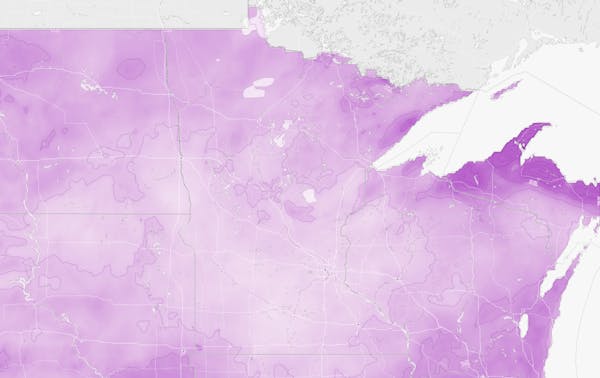
The Twin Cities was expecting the biggest snowfall of the year Sunday — almost a foot of it.
But it might not look like much Monday because snow is likely turn into rain in the morning.
"It'll melt and compact the snow, so people that do measure it in the morning after the night of snowfall will probably not measure 6 to 11 inches," said Caleb Grunzke, a meteorologist with the National Weather Services in Chanhassen. "It'll look like a lot less."
In some cases, the rain could melt all the freshly fallen snow in southern Minnesota, he said.
The snow is expected to change to a wintry mix — a combination of rain and snow — starting around 10 p.m. in the southern metro and by 1 a.m. Monday across the entire metro area, said Ryan Dunleavy, another meteorologist with the National Weather Service.
Before turning to rain by 6 a.m. Monday, he said, the snow will be heavy, wet and sticky.
Dunleavy said about 3 inches had fallen at the Minneapolis-St. Paul International Airport by 7 p.m., with up to 2 inches of snow could fall per hour later Sunday.
Central and western Minnesota could see anywhere from 11 to 16 inches of snow, Grunzke said. That includes Morris, Alexandria, Little Falls and possibly Duluth.
New Englanders appear to have suffered the brunt of the weekend storm. More than 2 feet of snow fell in some areas, causing crashes, downing power lines and leaving hundreds of thousands without electricity. Some of the highest snow totals exceeded 30 inches in south-central Vermont.
Snow- and ice-covered Interstate 35E might have contributed to a deadly crash in Burnsville on Sunday afternoon, the State Patrol said.
Elizabeth Marie Evans, 51, of Lakeville was fatally injured when her car veered off the northbound lane and hit a tree. She was taken to Regions Hospital in St. Paul, where she died.
Roads across the state were treacherous Sunday afternoon. The State Patrol reported 217 crashes between midnight and 4:30 p.m., including 116 car spinouts and five jackknifed semitrailer trucks.
Air travel was not badly affected, according to the Federal Aviation Administration, with most flights delayed less than 15 minutes.
The rain is forecast to continue throughout Monday; temperatures should be a degree or two above freezing in the morning before rising into the upper 30s and perhaps the low 40s later in the day.
Temperatures will dip back below freezing on Tuesday morning, so the morning commute could be a little icier, Dunleavy said.
"Both mornings will probably be a little bit of a challenge," he said. "But comparing the two mornings, Tuesday would be the better bet for a trickier drive."
There's a chance for more light snow on Tuesday morning or afternoon, but only an inch or 2.
And yes, this could still be the high mark for what has been a warm and not very snowy winter in Minnesota. The biggest snowfall in the Twin Cities so far this year was 6.9 inches on Valentine's Day.
"There's a good shot this would be the biggest snowstorm of this winter," Grunzke said. "We've just got to get to 7 [inches]."
This article contains information from the Associated Press.

Want to share info with the Star Tribune? How to do it securely

'Safe recovery sites' would offer syringes, naloxone and more to people using drugs. The plan could be in peril.
New Minnesota GOP leaders seek peace with party's anti-establishment wing

Who is Republican Lisa Demuth, Minnesota's first House speaker of color?

