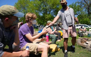
More Minnesotans may be calling in sick this week.
Blame it on a string of higher than normal temperatures that has folks keeping their shorts on and their flannel in their closets. High temperatures through Saturday will be in the mid-60s to 70s and possibly flirting with 80 degrees on Friday in some parts of the state. Added to that will be lots of sunshine.
Soak it up because the National Weather Service says this week's temperatures could be the warmest until next spring. Even northern Minnesota will be reveling in temperatures in the mid-60s and 70s, said Dan Effertz, weather service meteorologist.
None of this is record-breaking, but the warm bonus days are perfect for the annual state teacher conference that has many students out of class Thursday and Friday.
"Call in sick. Take your comp days," advises Twin Cities meteorologist Paul Douglas. "Take nothing for granted."
A large portion of the state has had frost, which means the bug count is down, there's less pollen flying through the air making life less miserable for allergy sufferers and there's no humidity, Douglas said.
"You can make a case that the next four days will be some of the best weather of the year," he added.
The sunny weather also is welcome news for farmers, who have been waiting to harvest corn, soybeans and other crops until the soil, saturated by rains earlier this month, dries out enough to support combines, grain carts and trucks. Although 89 percent of the feed corn had reached maturity as of Sunday, only 7 percent had been harvested, according to a U.S. Department of Agriculture report on Minnesota's crop progress. That's two weeks behind last year at this time and three weeks behind the five-year average.
Soybean farmers are also playing catch-up this week. Nearly all of the crop was mature, but only 45 percent had been harvested, compared with the five-year of average of 82 percent by mid-October.
The warm temperatures can help corn and soybeans to dry in the field, lessening the expense of drying them after harvest. Grain needs to lose much of its moisture so it can be stored safely in elevators and bins without risking spoilage caused by mold and fungus.
By Sunday, Twin Cities temperatures will fall to the low 60s — still a bit warmer than the normal temperature of 55. Even the low nighttime temperatures will be 10 to 20 degrees warmer.
By Tuesday, the mercury will dip to a more fall-like -temperature of 53 degrees, according to the weather service.
And while it might be the end of 70-degree days, high temperatures likely will hover in the 40s and 50s with maybe a few 60s popping up over the next several weeks.
"It's going to feel like fall," Douglas said. "I see no rush into winter. There's no onslaught of arctic air right around the corner."
By the end of the month, Halloween with a possible high of 50 degrees will continue to be fall-like with little chance of a mega snowstorm reminiscent of 1991, he said.
"Hopefully, that was a 1-in-a-100-year type of event," he added.
Winter weather doesn't usually creep in until about the third or fourth week of November, he said. By then, ground temperatures get colder, snow lingers and commutes become more complicated, he said.
"That's when winter really settles in," Douglas said. "Until then, we'll get a frosty morning here, a few flurries there. I wouldn't panic just yet."
So should fair-weather Minnesotans be nervous about the coming winter?
Well, there's no evidence the state is going to get hit with a "polar vortex winter," Douglas said.
"The odds are that it will be a milder than average winter because most of our winters now are milder than average."
Still, there's always a one-in-four chance that the state could get smacked with a sustained bitter subzero temperatures, he added, in hedging his bets.
The bottom line, it's too hard to predict what's to come except that it will be colder than it is now and there will be some snow, Douglas said.
marylynn.smith@startribune.com • 612-673-4788
tom.meersman@startribune.com * 612-673-7388

Want to share info with the Star Tribune? How to do it securely

'Safe recovery sites' would offer syringes, naloxone and more to people using drugs. The plan could be in peril.
New Minnesota GOP leaders seek peace with party's anti-establishment wing

Who is Republican Lisa Demuth, Minnesota's first House speaker of color?

