Where did suburban streetcar lines run and why were they removed?
Listen and subscribe to our podcast: Via Apple Podcasts | Spotify | Stitcher
A hundred years ago, you could get from Minneapolis to Excelsior as quickly as that 18-mile trip takes today at rush hour — about 45 minutes — but instead of fuming in gridlock, you'd breeze along, gazing at fields and trees from a streetcar.
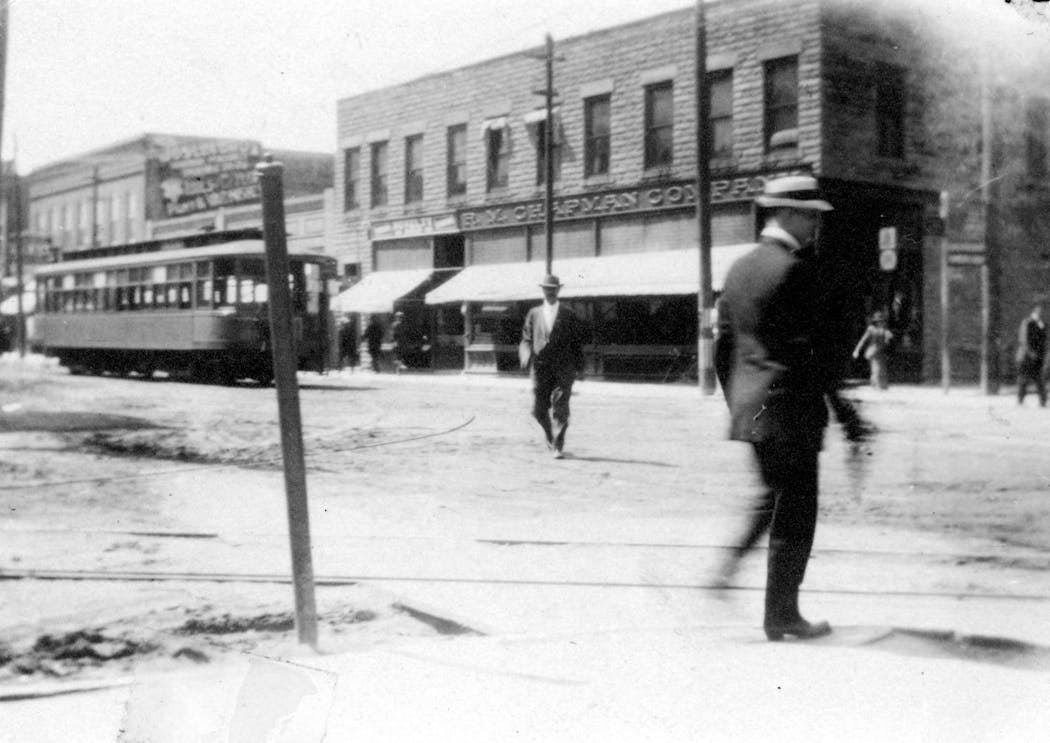
From the late 1800s to the 1930s, streetcars were the primary mode of travel within Minneapolis and St. Paul, but also east to Stillwater, Bayport and White Bear Lake and west to Lake Minnetonka.
Growing up in the metro area, Ken Gartner knew it once had a streetcar system. He has seen the paved-over tracks that periodically pop through worn downtown streets. When his family moved to Minnetonka five years ago, Gartner found a quiet wooded path that he deduced was the remnant of an old streetcar track to Deephaven, based on an map of the former route.
"One of these lines appears close to where we currently live," he said.
Gartner asked Curious Minnesota, the Star Tribune's community-driven reporting project fueled by questions from readers, for more information about the streetcars to cities surrounding Lake Minnetonka.
In the late 19th century, Thomas Lowry, owner of Twin City Rapid Transit, began laying tracks for electric streetcars to replace steam-powered commuter trains. At its peak, the company had 524 miles of track and carried 200 million riders each year — more than twice Metro Transit's total ridership in 2019.
Streetcars brought together people of all socioeconomic classes, said John Diers, co-author with Aaron Isaacs of "Twin Cities by Trolley: The Streetcar Era in Minneapolis and St. Paul."
"Everyone rode the streetcar — from millionaires to hobos," said Diers, a retired transit employee.
In 1906, a western line opened from Minneapolis to Hopkins, where it split into two tracks — one to Deephaven and the other to Excelsior and Tonka Bay. Tourists out for a day trip and commuters with homes or summer cottages could travel on the lake in steam-powered streetcar boats, also part of the transit system.
The route was called "The Great White Way," for its brightly lit tracks, or "The Line of Greenery and Scenery" for its views of open landscapes, decades before suburbs took over. Streetcar speeds could top 60 mph, about 20 mph faster than a Ford Model T.
"Once they got clear of the city limits at France Avenue, they got up and moved," said Isaacs, chief historian for the Minnesota Streetcar Museum in Minneapolis.
As automobile mass production grew in the 1920s and '30s, streetcar ridership dwindled. The Lake Minnetonka line closed in 1932. Car sales boomed after World War II, suburbs developed, and the last streetcar in the metro area ran in 1954.
Many people believe auto manufacturers conspired to drive streetcars out of business, but that's an urban legend, Diers and Isaacs said. Consumers simply preferred cars.
So the transit company switched to buses, cheaper to run but less pleasant to ride.
If you'd like to submit a Curious Minnesota question, fill out the form below:
Read more Curious Minnesota stories:
Why do tiny cities like Lauderdale, Landfall and Falcon Heights exist?
What's the story behind three curiously named south metro roads?
Why do so many Twin Cities mall names end in 'dale'?
Why is Minnesota the only mainland state with an abundance of wolves?
Why is Minnesota more liberal than its neighboring states?
Correction: Previous versions of this article misspelled the name of John Diers.


