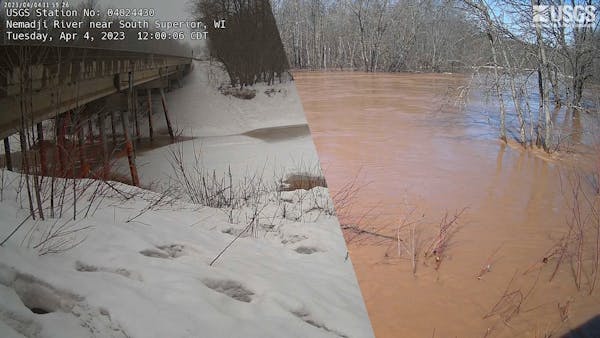
If the mostly dry weather holds for the next couple of weeks, Minnesota will avert widespread flood damage from rivers bloated from melted snow, emergency management officials said during a news conference Tuesday with Gov. Tim Walz.
Dan Hawblitzel, meteorologist in charge for the National Weather Service in the Twin Cities, said that although the state is "right in the middle of it" with the high rivers, "we should continue to round the top of this event."
"We just need to keep a very close eye on the weather patterns up ahead, making sure that nothing too extreme comes," he said, adding that an inch or two of rain won't be a problem.
Also speaking at the weekly briefing were Kevin Reed, interim director of the state Homeland Security and Emergency Management division, and Lt. Col. Rob Wilkins, deputy commander for the U.S. Army Corps of Engineers, St. Paul District.
Walz said that so far, the state has avoided major damage to homes and public roads, bridges and buildings. Reed, however, warned that it's too early to declare victory in averting major disaster.
Most rivers reportedly have crested and are receding. "For the most part, there's very little to any snow left to melt into rivers," Hawblitzel said.
But there are two areas of concern: the Red River north of Grand Forks and the Mississippi River downstream of St. Paul, where the high water has yet to fully wend its way south.
"There really isn't any barge traffic" on the Mississippi, Wilkins said, adding that it's still too dangerous for the vessels. He said he expects the water to begin receding in the next seven to 10 days.
Wilkins said nine of the 10 locks on the Mississippi are closed to barge traffic, starting with the one at St. Anthony Falls in Minneapolis. In closing them to traffic, the corps opens the locks and dams to allow the rushing water to flow through.
The exception is the lock and dam at Hastings, Wilkins said. It remains open because the water there has not yet risen high enough, he said.
But officials said they remain concerned about the snow that has yet to melt in the Arrowhead. The melt there eventually makes its way into Lake Superior, but it could create flooding problems en route, the officials said.
On Tuesday, the St. Louis County Board approved a resolution declaring a state of local disaster in northeastern Minnesota, where there has been a quick melt to the record-setting snow.
County staff gathered damage assessment estimates, according to a news release. St. Louis County had closed about 50 roads because of high water, but most had reopened by Tuesday. A few roads remained closed in the southwestern part of the county, including near Meadowlands.
Reed said damage in that region was already at $2 million, but it will take a couple more weeks to determine the full extent. "We can't do an assessment while the water is still there," he said.
Officials also repeatedly warned that the threat to public safety isn't over as rivers remain swollen, fast and unpredictable. Reed said the state highly recommends staying out of and away from the water to avoid a risky rescue or worse.
"I know you want to take pictures. Go ahead, use your zoom lens to do that," Reed said. "The rivers are still high. We saw people canoeing down the Mississippi the other day."
Staff writer Christa Lawler contributed to this report.

Want to share info with the Star Tribune? How to do it securely

'Safe recovery sites' would offer syringes, naloxone and more to people using drugs. The plan could be in peril.
New Minnesota GOP leaders seek peace with party's anti-establishment wing

Who is Republican Lisa Demuth, Minnesota's first House speaker of color?

